I want to use tools to...
I have access to...
I need a tool that...
My Earth Defenders Toolkit

I am using tools to:
I have access to:
I need a tool that:
Clear all filters (0)
SELECTED TOOLS
No tools meet these criteria. If you would like to share more about your needs with the Earth Defenders Toolkit community to see if somebody can help, please feel free to post in the Forum.
If you know of a tool that matches these needs, please also feel free to share information about that in the Forum.
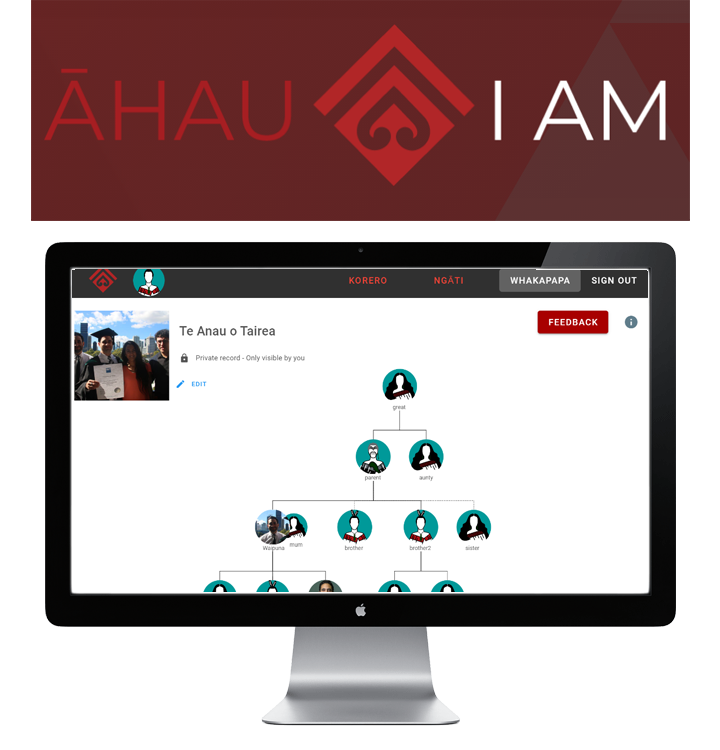
Āhau
Āhau is a Whānau (Māori-language word for extended family) Data Platform that helps whānau-based communities capture, preserve, and share important information and histories into secure, whānau managed databases and servers. It is good for maintaining family registries and capturing and preserving cultural heritage, and all data is collected, stored and shared using your own personal devices. Āhau is easily installed on any PC, Mac, or Linux computer. Why use Āhau, in the words of the creators: “You can use Āhau whenever you come across an important piece of information that should be remembered and stored safely for future generations.”
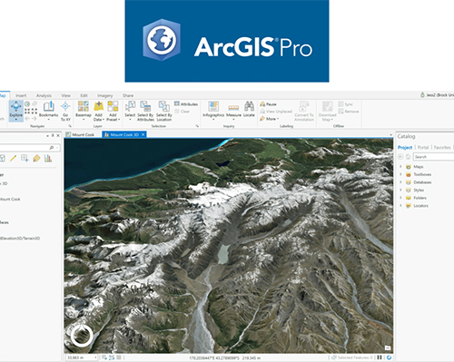
ArcGIS Pro & ArcMap
ArcGIS Pro and ArcMap are geographic information system (GIS) software applications for working with maps and geographic information, maintained by the company Environmental Systems Research Institute (Esri). These tools are used for creating and using maps, compiling geographic data, analyzing mapped information, sharing and discovering geographic information, using maps and geographic information in a range of applications, and managing geographic information in a database. The two applications provide similar tools and functionality - ArcMap (also known as ArcGIS Desktop) is the older software that has been around for almost twenty years, and ArcGIS Pro is a much newer version; eventually, Esri plans on phasing out ArcMap completely in favor of ArcGIS Pro, but they are still maintaining ArcMap because many users are still actively working with it. ArcGIS is considered the industry standard for GIS software, and it is used by many government entities, academics, non-governmental organizations, tribal councils, and others that may contribute to or intersect with projects by earth defender communities. It is, however, proprietary software and can be expensive. In some countries like North America and Canada, it is relatively easy to get access for (registered) Indigenous communities, but elsewhere it can be trickier.
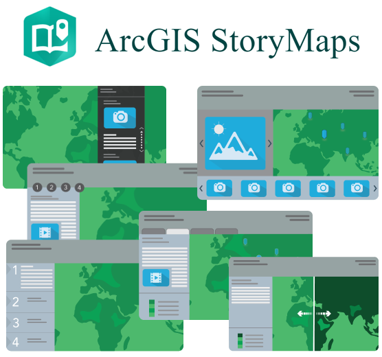
ArcGIS StoryMaps & Dashboard
ArcGIS StoryMaps and Dashboard are two tools for sharing and visualizing information online, maintained by the company Environmental Systems Research Institute (Esri). ArcGIS StoryMaps is a story authoring web-based application that enables you to share your maps in the context of narrative text and other multimedia content. Many earth defender communities have used StoryMaps to tell stories about their land, culture, or history using interactive maps and other media content. The template is easy to use and doesn’t require any technical knowledge, and offers a lot of options for laying out maps, and customizing the design. ArcGIS ArcGIS Dashboards can be used to make sense of location-based data using intuitive and interactive data visualizations on a single screen. You can put together a Dashboard with maps of your land along with graphs and analysis of field data, and important geospatial information like deforestation data or zonal demarcations. Both tools utilize Esri’s ArcGIS Online platform where the maps and data are stored.
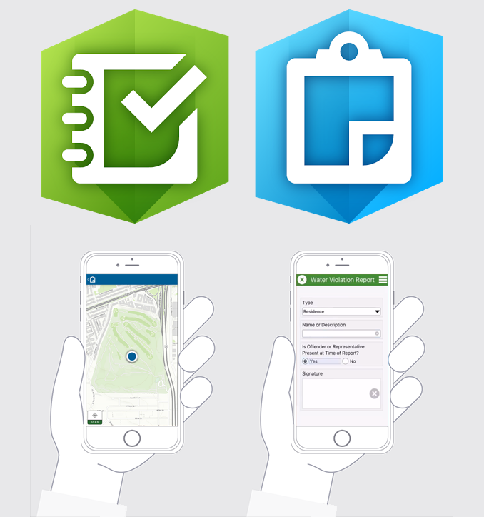
ArcGIS Survey123 & Collector
ArcGIS Survey123 and Collector are field data collection applications, maintained by the company Environmental Systems Research Institute (Esri). Both applications allow you to create and fill out custom forms and questionnaires, with the option to collect and update geospatial data including points, lines, and polygons. You can also add the option to take a photo. Like OpenDataKit or KoboToolbox, you can create your own forms and provide your own translations, including the ability to choose between languages. There are also user-friendly web-based interfaces for building these surveys, which makes it really easy to get started using these tools. The way it works is that once you have downloaded a form, you can fill it out while in the field, and then submit the data when you come back online - it will then be collected on ArcGIS Online along with other people’s data submissions. From ArcGIS Online, you can either download the data, or use it in an application like ArcGIS Dashboards or StoryMaps. The main difference between Survey123 and Collector is that you can build more advanced forms using Survey123 with “nested” questions that follow up on one of your previous responses. Also, the interface for Collector is more map-based, similar to an application like Mapeo Mobile, whereas Survey12 is more focused on the form itself. Earth defender communities have used these tools for both mapping and monitoring purposes.

Cadasta
Cadasta offers an open and flexible suite of mobile and web-based tools designed to help users collect, manage, and store land and resource rights data. Cadasta’s current platform is built on ArcGIS and offers communities free access to Esri’s wide array of tools for purposes of land and resource rights data collection and monitoring. (See the other ArcGIS tools in this guide for more information on those.) Cadasta also has a very helpful training and support center with training courses, a knowledge base, community forum, and support from their staff to answer questions about their toolkit. Their resources are available in English, French, Portuguese, Spanish, Kiswahili, Bangla, Hindi, and Indonesian.

Community Lands
Community Lands allows users with very limited computer literacy and with no internet access to build their own website from scratch. The software was developed for local communities who wanted these websites to showcase their way of life, and to publish news and stories about the threats and challenges they face and the host of efforts they engage in to protect their lands. Community Lands is open-source software for creating and laying out a local website while offline, which can also be uploaded to an online server if the community choses to do so. This can be a useful tool for earth defender communities who want to maintain information about themselves or their land (like a land or management plan), and in some cases, share that information with a broader public.
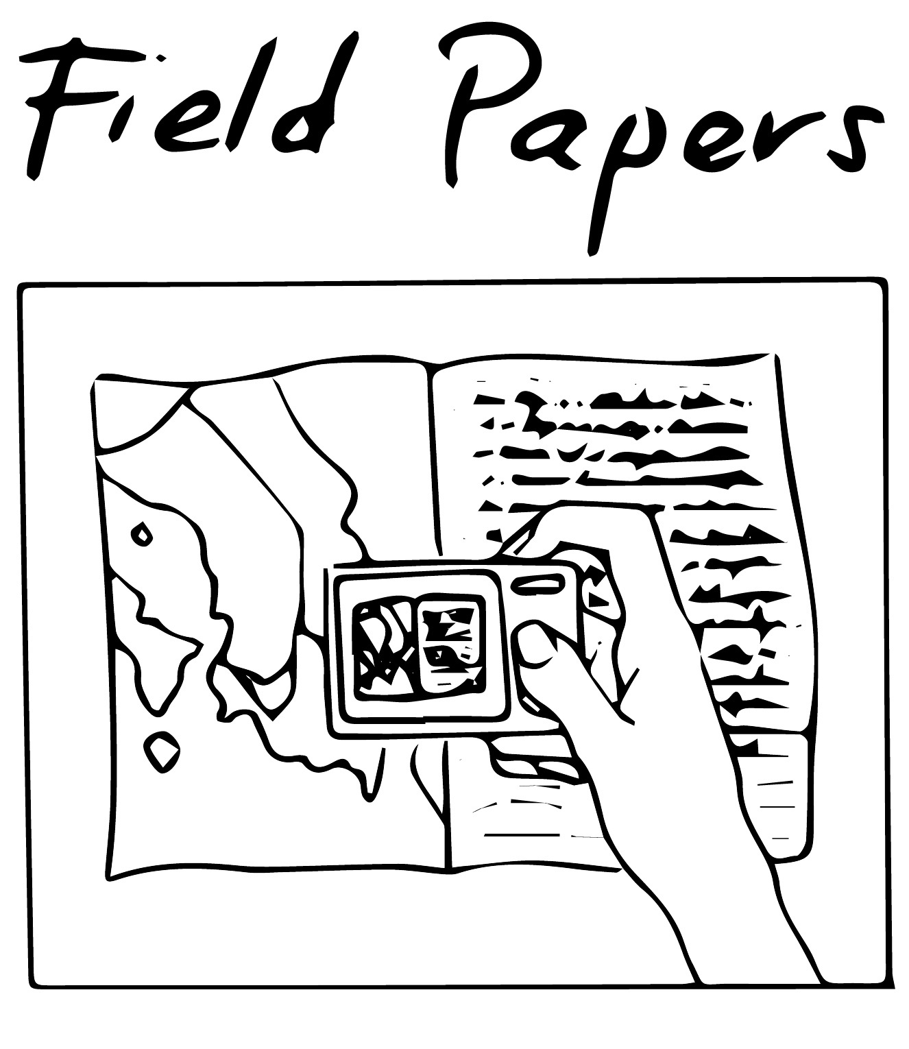
Field Papers
Field Papers is a tool to help you make annotations or sketches on a printed map, and easily integrate that back into the map. The way it works is that you can print out pages of a map. Community members can draw or write on those maps. The pages come with a QR code which is used to bring that information back into the maps by putting the information in a geographical information system (GIS) format. This can be useful for mapping workshops where you are trying to get input from many community members at once, and/or you want everyone to have their own map page to work with. The standard map used by Field Papers is OpenStreetMap but it’s possible to put in your own maps.
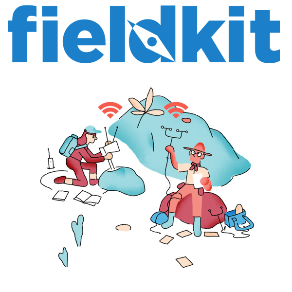
FieldKit
FieldKit is a low-cost environmental sensing tool (hardware and software) that can be used to measure and collect data about water quality, air quality, and weather conditions. FieldKit stations are built to be easily deployed, and an accompanying mobile app makes configuration and maintenance simple. There is an online platform that can help you visualize the station data, discover trends and patterns, and share your findings. FieldKit was created in the context of a conservation project in the Congo rainforest to measure microclimates in the forest canopy. The FieldKit staff is very interested in potential usage of their tools by Indigenous and other local communities, and would welcome inquiries by getting in touch via their website. According to FieldKit, the Hardware is built with environmentally responsible manufacturing conditions, and you can send back equipment to them for recycling and re-using.
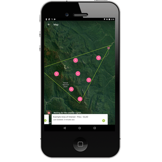
Forest Watcher
The Forest Watcher mobile app brings the online forest monitoring and alert systems of Global Forest Watch offline and into the field. By setting up an area to monitor and downloading deforestation and fire alerts, you can take this information with you to help investigate and report what you find, regardless of Internet connectivity. There is also a web version of the application which allows you to view and collect reports, create and assign areas of interest, and upload your own contextual data. This application is useful for earth defender communities who wish to monitor and report on land use changes or environmental threats taking place in their land. It is frequently used in tandem with the Global Forest Watch platform or MapBuilder, which are also covered in this guide.
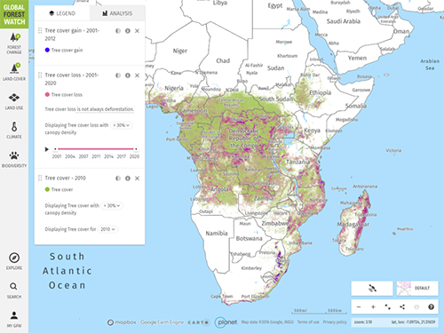
Global Forest Watch
Global Forest Watch (GFW) is an online platform that provides data and tools for monitoring forests. GFW allows anyone to access near real-time information about where and how forests are changing around the world. The main GFW interface is an interactive map of the world where you can turn different layers on and off for data such as forest change (including near real time deforestation alerts), land cover, land use, climate, and biodiversity. You can also use the interface to analyze deforestation trends for specific areas, either ones on the map (like a country or province), your own data which you can upload, or an area of interest you can draw directly on the map. It’s possible to create an account where you can subscribe to receive alerts and reports about areas. Communities and organizations around the world use GFW to monitor and manage forests, stop illegal deforestation and fires, call out unsustainable activities, defend their land and resources, sustainably source commodities, and conduct research at the forefront of conservation.
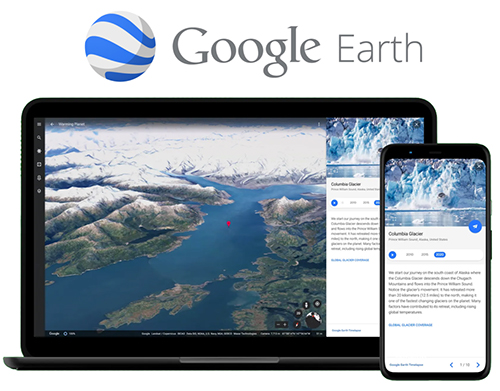
Google Earth
Google Earth is a tool that provides satellite imagery for the entire world and allows users to search, pan, zoom, rotate, and tilt the view of the earth. Google Earth is available on several platforms: on the web, as a smartphone application, and there is a Desktop application called Google Earth Pro that is gradually being phased out. Rather than being a geographic information system (GIS) tool that provides advance analysis or cartographic design capacity, Google Earth focuses on delivering a seamless experience navigating a comprehensive archive of satellite imagery of the planet. In Google Earth web and Pro, you can add geographic data including GPS data and geospatial shapefiles, and also export views for print. With the Google Earth creation tools on the web, you can add your photos and videos, customize your view, create tours, and share and collaborate with others. Due to its ease of use and exceptionally clear 3D satellite imagery views, earth defender communities have used Google Earth to do “direct-to-digital” mapping where community members can easily identify, map, and share stories about places and features in the landscape. The Google Earth web interface has also been used by some communities to share information about storied places in their lands with the public.
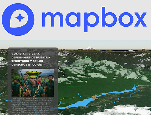
Mapbox
Mapbox is one of the largest providers of custom maps for websites and mobile applications. Mapbox consists of a library of code that software developers can use to make their own map applications, as well as several applications. One of these applications is Mapbox Studio, which map designers can use to create and customize interactive maps using a user-friendly interface. Map styles created in Mapbox Studio can be exported and used by many other applications that can be useful for earth defender communities, such as Mapeo, Terrastories, and Ushahidi. More recently, Mapbox has also created a tool for telling stories using maps akin to Esri’s ArcGIS StoryMaps. While Mapbox’s interactive storytelling tool is not as easy to configure as ArcGIS StoryMaps and requires editing some code, it is free and very easy to host on your own server. Mapbox also has an extensive library of open-source tools, including some for generating map tiles that can be used in offline mapping applications. One of the latest developments by Mapbox has been the creation of a 3D Terrain layer which coupled with high resolution satellite imagery can be highly effective for visualizing local geographies, depending on location and accessibility of imagery. The Mapbox community team is keen to help Indigenous and marginalized communities use their tools, and welcomes inquiries from communities looking to use their tools; check out how they’ve helped communities and get in touch with them at https://mapbox.com/community.
Mapbuilder
Want to create a version of the Global Forest Watch map, featuring your own data? MapBuilder is an easy to use tool which enables users to combine their own datasets with Global Forest Watch’s cutting-edge data and analysis tools. You can use MapBuilder to set up your own version of GFW with your own geospatial data layers, a custom map view, and provide some custom translations. MapBuilder applications can be deployed as stand-alone websites, embedded into your website or shared using integrated social media tools. Communities and organizations around the world use MapBuilder to monitor and manage forests, stop illegal deforestation and fires, call out unsustainable activities, defend their land and resources, sustainably source commodities, and conduct research at the forefront of conservation.

Mapeo
Mapeo was built with and for earth defenders to easily document environmental and human rights information and to collect data about their land. It can be used by individuals or by teams who want to collaborate and share information, and is particularly good at working in offline and remote environments. It is simple to use, free and accessible, and can be customized with local languages and settings .There is a Mapeo Mobile app, used to gather evidence in the field, to take photographs or record GPS points of significant places; and there is a Mapeo Desktop app, used to organize data collected on mobile or GPS, and to visualize, edit and create reports on which action can be taken which would be hard to do on a mobile. Both tools can work for individual or team projects as you can synchronize data between mobile devices, and from mobile to computer.
Mapeo was co-designed and developed with Indigenous communities who face threats to their land such as illegal gold mining, oil contamination and poaching and who want to document these activities in order to take community action against them, to report them to authorities, file lawsuits, launch media campaigns, or create maps for land claims.
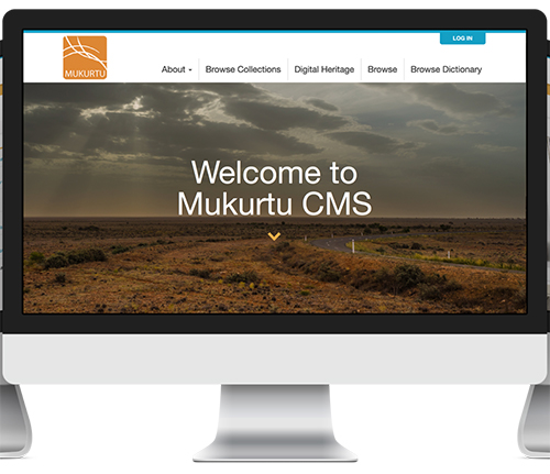
Mukurtu
Mukurtu is a free, mobile, and open source platform built with Indigenous communities to manage and share digital cultural heritage. Mukurtu (MOOK-oo-too) is a grassroots project aiming to empower communities to manage, share, and exchange their digital heritage in culturally relevant and ethically-minded ways. It is an archives content management system built on top of the Drupal platform, with core features tailored to the needs of Indigenous communities. These include support for traditional knowledge (TK) labels, cultural protocols that allow for fine-grained levels of access depending on community needs and values, community records for artifacts that allow for multiple stories and narratives, Indigenous language dictionaries, and easy importing and exporting to ensure that the integrity of the data is maintained. There is a Mukurtu Mobile application which enables users to easily add content on the go to their Mukurtu CMS site. The Mukurtu team commits to maintaining an open, community-driven approach to Mukurtu’s continued development, and their stated first priority is to help build a platform that fosters relationships of respect and trust.
OpenDataKit / KoboToolbox
OpenDataKit (ODK) and KoboToolbox are open-source applications for collecting, managing, and using data in resource-constrained environments. The tools allow for offline data collection with mobile devices in remote areas, using customized forms that users can design to meet their needs. The submission of the data to an aggregate server can be performed, when Internet connectivity is available, and data can be downloaded from the aggregate server and further processed (for example, in GIS software). Forms can be translated into multiple language, and designed to be quite complex with nested (follow-up) questions. You can record GPS location as well as capture photos, audio, and video in the forms. There are form builders available with a user interface that enables you to lay out forms without having to do any coding. Both ODK and KoboToolbox use the same data collection form template called XLSform, and forms created in one application can work in the other. The difference between the two tools is that KoboToolbox was designed to be suited for humanitarian emergencies and other challenging field environments, and provides some analysis and visualization tools for these purposes. Many earth defender communities have used both tools across the globe extensively for mapping and monitoring purposes, though frequently in collaboration with an NGO ally or technical expert who can download and process the data for the community.
OpenDroneMap
OpenDroneMap (ODM) is an open-source toolkit used to process aerial imagery captured by drones into maps and 3D models. Since ODM was created in 2014, it has become the go-to software for open-source drone imagery processing. There are a number of tools in the ODM toolkit including command-line code which can run on your local machine, as well as a user-friendly web-based application that can also run offline on your local machine, called WebODM. You can use ODM to process drone imagery to make digital elevation models, analyze plant and forest vegetation, export images in a JPG or TIFF format, make 3D maps, among many other things. ODM has an active forum where users can ask questions to the community and software maintainers. Nevertheless, processing drone imagery is very difficult and technically demanding no matter the software, and you may need some technical assistance to use this software. Earth defender communities have used drones to monitor changes taking place in their lands, especially in forest regions where it may be hard to find satellite imagery due to frequent cloud cover.
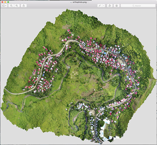
PIX4D
PIX4DMapper is a commercial app that will create a high-resolution map or 3D model from drone photos. You can use the free PIX4Dcapture mobile app to plan a drone flight and take multiple photos in a grid over the area you wish to map. You can process these images with PIX4Dmapper and it will create an orthophoto (an orthophoto is like satellite imagery — a high resolution geo-referenced photograph of the ground, created by merging multiple images from a drone) and a 3D model that shows hills, trees and buildings in the area mapped.
Portable OpenStreetMap
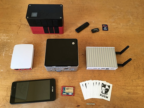
Portable OpenStreetMap or "POSM" is a project that brings together a handful of mapping tools onto a portable device which works without an internet connection. While the name suggests that the focus is on OpenStreetMap (OSM), it comes bundled with a number of other tools which normally rely on online servers or extensive local set up; these include several tools on this guide, such as Field Papers, a specific version of OpenDataKit called OpenMapKit, and OpenDroneMap. POSM was developed to support humanitarian field mapping workflows where there is no reliable network or basecamp where data synchronization could take place, hence the need to have an offline workflow and software being important. POSM enables people to bring OSM data and the mapping tools into the field on very small servers that host their own wireless local area network, allowing data processing to occur without any access to the Internet at all. POSM devices are small form-factor PCs running Linux, built from components that can be purchased for about $300. They are sufficiently lean enough to be powered by commonly available sources, such as motorcycle batteries. POSM is being developed by the American Red Cross and there is a community of users including the Humanitarian OpenStreetMap and Missing Maps organizations.
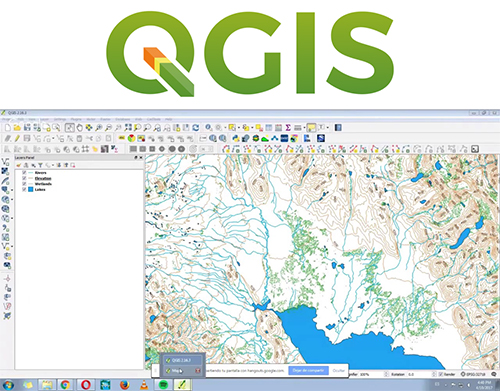
QGIS
QGIS is a free and open-source cross-platform desktop geographic information system (GIS) application that supports viewing, editing, and analysis of geospatial data. It is the most powerful and commonly used GIS software that is open-source and free to use. QGIS provides much of the same core functionality as Esri's ArcMap and ArcGIS Pro software, including processing analyzing raster and vector layers, georeferencing images, analyzing satellite imagery, and designing cartographic maps. It is however not as easy to use as Esri's tools, lacks some of the more advanced mapping functionalities, and has only limited support for web mapping. Many earth defender communities use QGIS in tandem with data collection tools such as Mapeo, OpenDataKit, Sapelli, GPS handheld units, and others; once data has been collected and minimally processed within those applications, it is exported to QGIS for more sophisticated data organization, analysis, exporting, and cartography. QGIS has a wide community of users globally, and there are both forums to ask questions and numerous tutorials for using QGIS.
Sapelli
The Sapelli Collector software aims to enable people with no or limited literacy – in the strict and broader technological sense – to use smartphones and tablets to collect, share, and analyse (spatial) data. Sapelli is used in a variety of projects related to environmental monitoring. It enables communities, regardless of social and geographical background, to map their environment and any threats it faces. The Sapelli Collector application can be used to create forms that use a visual language that enables a user to collect data or monitor threats without needing to read any text. The reports may be sent via SMS, WiFi, or data to a server called GeoKey which has a special data structure and user rights management attuned to community needs. Sapelli has been used by forest communities in Africa to report on illegal wildlife crime. The Sapelli Collector software was developed by the Extreme Citizen Science (ExCiteS) research group at University College London.

Terrastories
Terrastories is a web application for communities to map, protect, and share stories about their land. It can be used by individuals or communities who want to connect audio or video content to places on a map. It is designed to be user-friendly and fun to interact with, allowing community members to freely explore without needing any technical background. Terrastories began when a team of geographers and software developers decided to start building Terrastories to help a community in South America map their place-based oral histories. The Matawai Maroons of Suriname, a community of formerly enslaved Africans who fled into the forests over three centuries ago and reside there today, wanted to map oral histories about when their ancestors first arrived in these lands. The community leaders were interested in having a tool that helps the young people get to know these places, their history, their culture, and who they are as a people. Terrastories was built to accommodate that need, which the team also heard about from other communities across the globe.
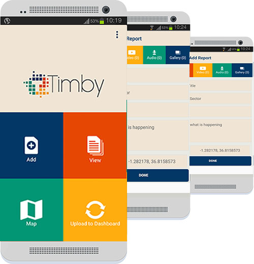
TIMBY
TIMBY (This Is My BackYard) is a digital suite of tools for reporting and monitoring built for citizen journalists and activists. TIMBY consists of three intercompatible tools: a reporting app, an investigation dashboard, and a storytelling tool. Users can utilize the encrypted reporting app to create reports, which can be synced with the dashboard for further aggregation with other reports, analysis, and data visualization. They can also use the storytelling tool to turn field reports into a published narrative for advocacy or citizen journalism purposes. TIMBY has been used extensively in Africa and Southeast Asia, particularly by civil society organizations but also some Indigenous groups. The TIMBY team has project managers and access to lawyers and journalists for communities that may need additional support.
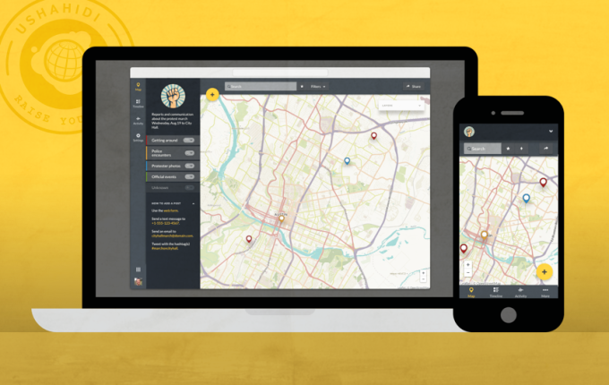
Ushahidi
Ushahidi is an open source software application which utilises user-generated reports to collate and map data. It uses the concept of crowdsourcing serving as an initial model for what has been coined as "activist mapping" - the combination of social activism, citizen journalism and geographic information. Ushahidi allows local observers to submit reports using their mobile phones or the Internet, creating an archive of events with geographic and time-date information. The Ushahidi platform is often used for crisis response, human rights reporting, and election monitoring.] Ushahidi (Swahili for "testimony", closely related to shahidi which means "witness") was created in the aftermath of Kenya's disputed 2007 presidential election that collected eyewitness reports of violence reported by email and text message and placed them on a Google Maps map. The application Ushahidi is being maintained by a global not-for-profit technology company with the same name, whose mission is to develop integrated tools and services to enable people to generate solutions and mobilize communities for good.
Acknowledgment: The Earth Defenders Toolkit is being built in solidarity, consultation, and co-creation with Indigenous and marginalized communities in Latin America, Asia, and Sub-Saharan African at every point of the way. We are deeply grateful to our partners who are working to achieve transformative change, and help us understand how we can best serve their needs.